About Baarle
Baarle, the most remarkable village in the world.
30 pieces of Belgium and the Netherlands that are intertwined. On the map it is called Baarle-Nassau and Baarle-Hertog. A village, unique in its duality: two municipal authorities with two mayors and two schools. But with one population, which goes hand in hand with its two nationalities. Without realizing it, you cross the border dozens of times. Tired but satisfied, after a long day, you sit down to taste cross-border delicacies in a cozy restaurant or pub. Visit and experience Baarle and secretly cross the border…..
The village of Baarle, consisting of the Dutch municipality of Baarle-Nassau and the Belgian municipality of Baarle-Hertog, is located in the middle of the imaginary triangle of Breda, Tilburg and Turnhout. It is often thought that Baarle is located exactly on the border of the Netherlands and Belgium, with the border running through one street. However, this is incorrect. In Baarle there is an enclave situation. An enclave is a piece of territory that is completely surrounded by the territory of another state. What makes Baarle so unique is that there is no single enclave; there are thirty in all!
There are still 63 enclaves worldwide. Baarle-Hertog-Nassau has 30 enclaves, almost half of the world's total. So we can proudly say we are the "Capital of the Enclaves." We are the WORLD CAPITAL OF ENCLAVES!
Baarle-Hertog
The Belgian Baarle-Hertog consists of 22 enclaves. These 22 pieces of land are completely surrounded by Dutch territory. Just across the official national border, in Belgium, is the parish of Zondereigen, which also belongs to the municipality of Baarle-Hertog. The entire municipality of Baarle-Hertog has an area of 748 hectares with approximately 3,100 inhabitants.
Baarle-Nassau
The Dutch Baarle-Nassau in turn has 8 enclaves, of which 7 are sub-enclaves in the two largest Belgian enclaves and one near the church village of Zondereigen. In addition to the core of Baarle-Nassau, the church village of Ulicoten and the hamlet of Castelré belong to the municipality of Baarle-Nassau. Castelré is located as a peninsula in Belgium, 11 km from the center of Baarle-Nassau. The entire municipality of Baarle-Nassau has an area of 7,641 hectares with approximately 7,200 inhabitants.
Border clearly visible
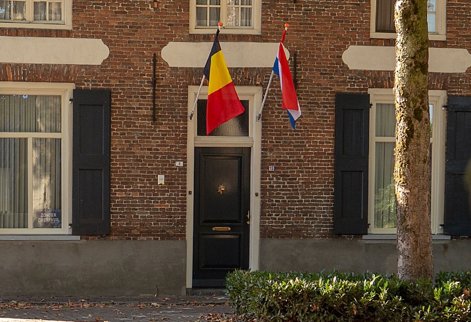
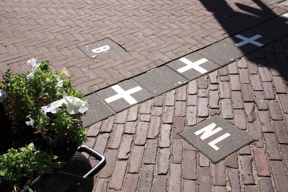
In Baarle, the border runs criss-cross through roads, houses and gardens. In the built-up area of Baarle, the enclave boundaries are made visible everywhere with the help of special paving stones and aluminum plates in the road surface. This way you can see exactly where the border is. You can also see the national tricolor on the house number plates whether the front door of a house or building is located in Belgium or the Netherlands.
Click here for the map.